global mapping
INTERTIDAL & SUBTIDAL
Data collection
The fundamental objective of a field survey is to identify seagrass occurrence from other benthos and, if possible, document seagrass state and determine the meadow edges/boundaries.
Field surveys are also essential when the mapping approach includes high-earth or spaceborne image capture (e.g. drone, airplane or satellite) to evaluate image signatures, examine areas where the imagery does not provide information (e.g., optically complex waters such as in areas of heavy turbidity), and to provide validation data for accuracy assessments.
Seagrass state can be determined by measuring a number of essential variables (seagrass percent cover and species composition) and supporting variables (e.g. sediment, water depth, water clarity / turbidity).
Field surveys can be executed using a range of methods which can be conducted by foot or from a vessel (e.g. boat, drone, helicopter).
Methods can include walking, diving (free or SCUBA), benthic grabs or sleds. The type of method is dependent on the type of environment.
Subtidal/Intertidal spot-check
Spot-checks are where the field validation is conducted at a specific point in the Area Of Interest and observations of benthic variables are measured in situ or post hoc.
The point can be predetermined in the planning phase of the survey strategy or ad hoc (when necessary or needed). The size (radius) of the point where the spot-check is conducted is generally the positional accuracy of the geolocation device (e.g. 1-3m).
Field measures can be collected using photoquadrats, quadrat observations or sampler observations. Spot-checks can be conducted: in person by foot, diving (free or SCUBA), or drone; remotely using drop camera, ROV; or via a sampler, such as a grab, rake, sled.
Although only one observation (sample) is necessary at a spot-check, it is recommended to take replicate samples spread within the point (e.g. 3 observations) to ensure the variation of point characteristics are well represented. This can be done by haphazardly dropping/lowering subtidal drop camera within an area of an approximate 1-3 metre radius around you, and recording the quadrat measures each time.
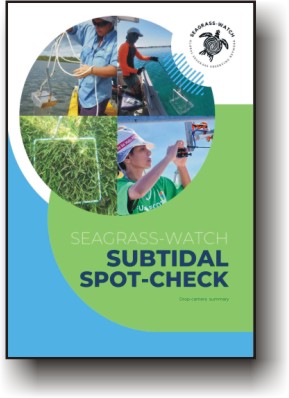
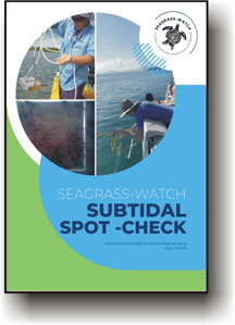
Subtidal spot-check using a Drop Camera
Subtidal spot-check demonstration video
Please note: This video is only intended for demonstration purposes. For more detailed information and consultation, please contact Seagrass-Watch HQ
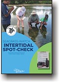
Intertidal spot-checks
If the mapping approach is field-based, then the simplest procedure is to conduct field mapping using spot-checks and boundary tracking.
Depending on the size of the AOI, spot-checks can be conducted in a grid pattern or along lines perpendicular to shore, with haphazard points in-between.
When mapping a region of relatively homogenous coastline between 10 and 100 km long, it is recommended that survey lines should be no further than 500-1000 m apart from each other. For regions between 1 and 10 km, it is recommended survey lines be approximately 100-500 m apart and for localities less than 1 km, it is recommended 50-100 m apart.
This however may vary depending on the complexity of the regional coastline, i.e., more complex, then more lines required. Survey lines generally follow a compass bearing and distances can be estimated, rather than accurately determined using a tape measure
Although only one observation (sample) is necessary at a spot-check, it is recommended to take replicate samples spread within the point (e.g. 3 observations) to ensure the variation of point characteristics are well represented. This can be done by haphazardly tossing a quadrat within an area of an approximate 1-3 metre radius around you, and recording the quadrat measures each time.
Photo transects
Field observations are collected using photoquadrats (still or video) conducted in person (by foot, diving – free or SCUBA) or remotely using an underwater drone or towed video sled. Measures of seagrass and benthic variables are conducted post hoc by a scientist or using machine/deep learning.
Each photoquadrat captures a 1m2 area of the benthos, every 2-3 meters along 100+m long transects positioned in transitional zones to capture the full range of benthic types (e.g. bare substrate to sparse seagrass to dense seagrass to algae to reef).
Photo-transect locations are chosen based on expert interpretation of high or spaceborne imagery to determine best placement to ensure coverage of the variety of benthic cover types to provide the most benefit for the mapping calibration / validation. The direction and length of the transects ensure that the photos capture the variance in the benthic composition.
Transects are often perpendicular to the perceived meadow boundary. The transect locations are generally pre-planned on available imagery as waypoints of either end of the transect that can be uploaded to a handheld GPS unit for the field.
Photo-transects can be conducted by foot when the area to be surveyed is exposed during low spring tides, or the water is very shallow (<0.5m depth), sea state smooth and water clear.
Intertidal spot-check demonstration video
Please note: This video is only intended for demonstration purposes. For more detailed information and consultation, please contact Seagrass-Watch HQ
Header image: Dimitris Poursanidis


